

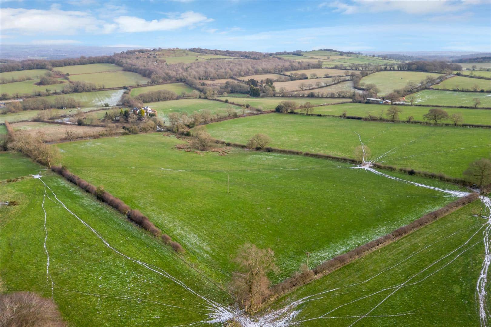
The land extends to approximately 127.45 acres (51.57 hectares) of productive arable land with potential also for environmental uses and BNG offsetting.
Location
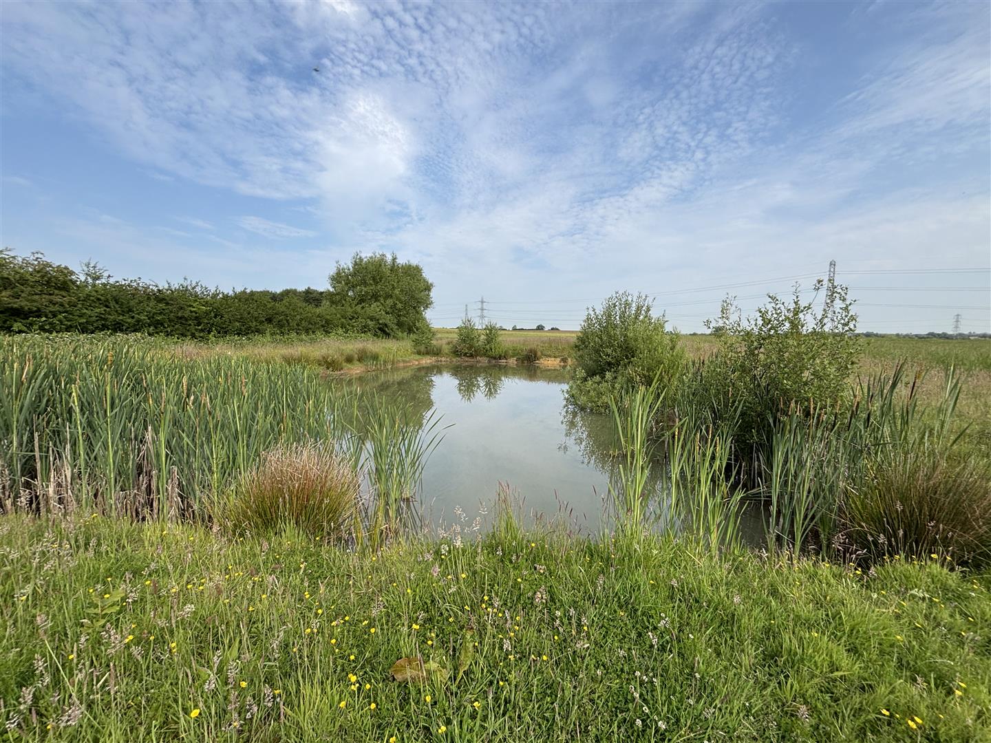
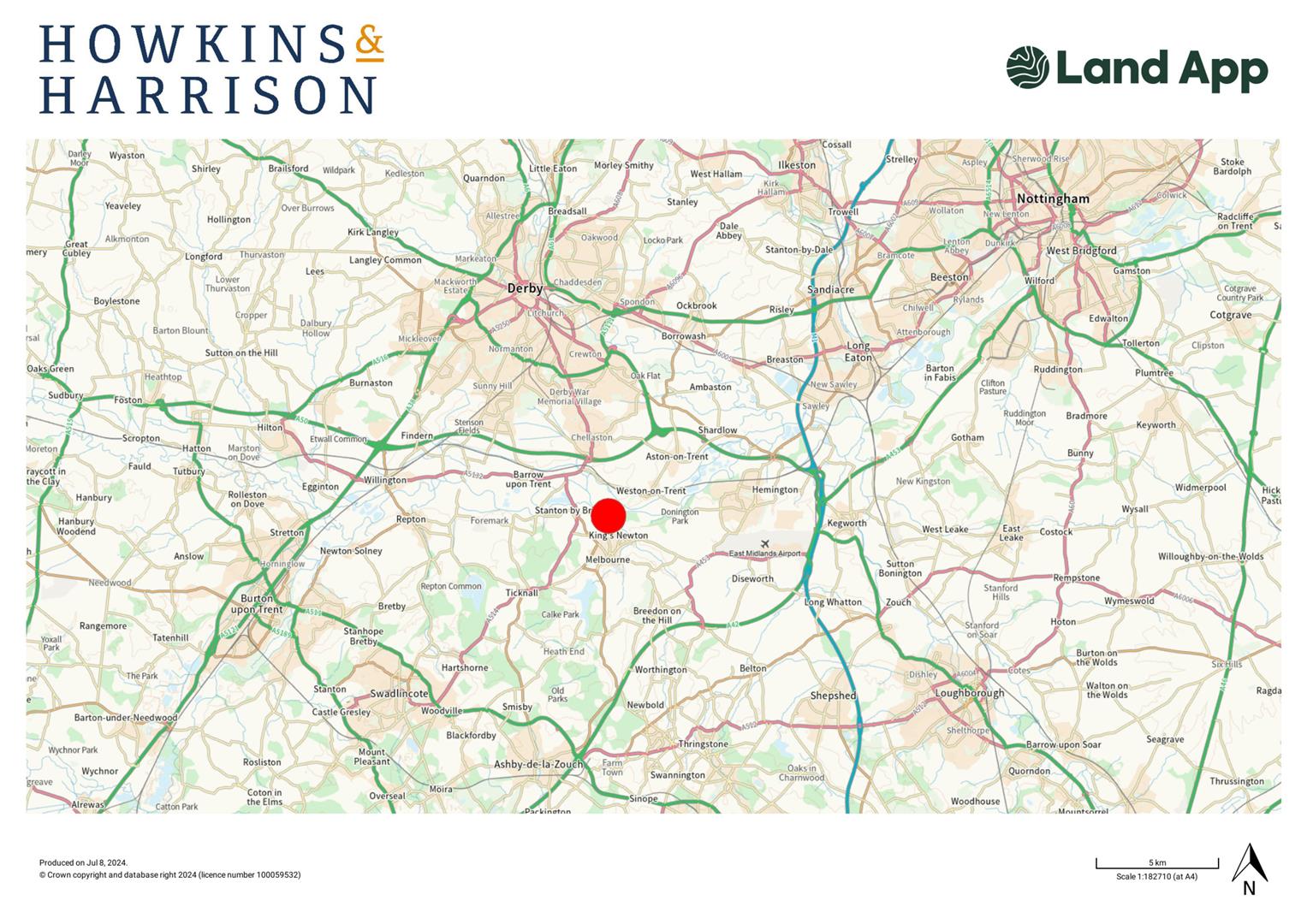
The land holds a rural location to the north of Kings Newton village and is bordered to its northern boundary by the River Trent. The land has multiple means of access leading from Wards Lane and separately from Trent Lane.
The land benefits from excellent transport network links with Junction 3 of the A50 located within approximately 3.5 miles and Junction 23A M1 motorway network approximately 6 miles away which provides access to the wider Midlands region and beyond.
Description
The land extends to approximately 127.45 acres (51.57 hectares) of productive arable land, albeit with potential also for environmental uses and BNG offsetting.
The land is a combination of Grade 2, 3 and 4 as per the Agricultural Land Classification Map, and the topography of the land is relatively flat. To the northern boundary the land adjoins the River Trent, part of the land falls within a flood zone 3 area.
The land is currently subject to a mid-tier Countryside Stewardship Scheme
The buyer will be responsible for erecting a new deer fence between points
A-B-C on the sale plan. The exact specification of the deer fence to be agreed between the parties.
Flood Zone
Part of the land sits within a Flood Zone 2 and 3 area and is therefore at risk from flooding.
Access
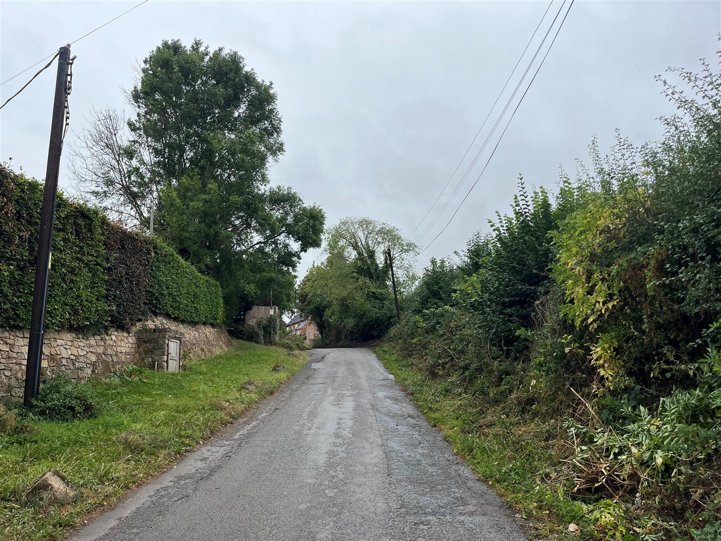
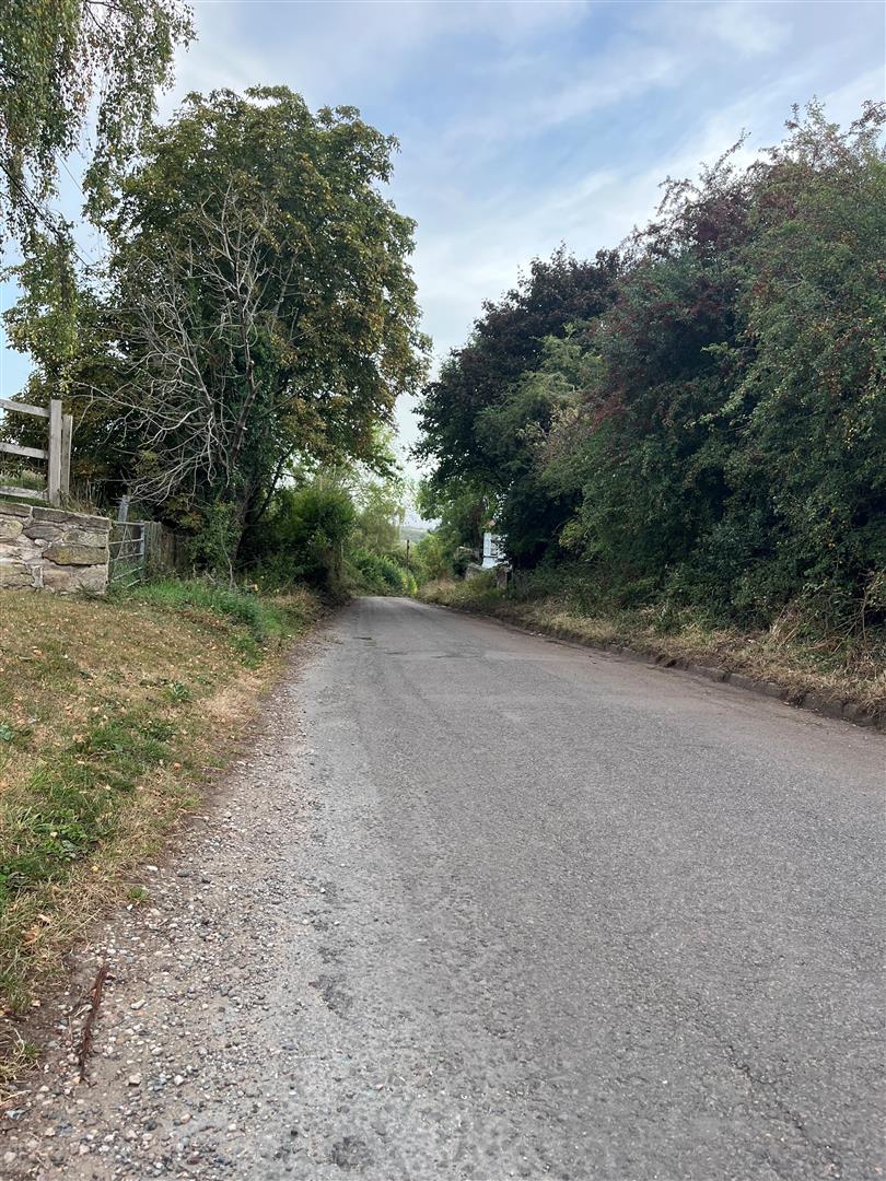
The land has access directly off Wards Lane which is publicly adopted.
The buyer will also be granted a right of way from Trent Lane through the existing farm entrance to gain access to the land. This is shown coloured brown on the sale plan.
Services
We understand that the land does not benefit from any mains services.
Purchasers should make their own enquiries regarding the location of mains service supplies.
Wayleaves, Easements & Rights of Way
The land is not impacted by any public rights of way.
High voltage electricity pylons and overhead lines are present of the land.
The land is sold subject to and with the benefit of all other easements, wayleaves and rights of way that may exist at the time of the sale whether disclosed or not.
Sporting Rights
Where Sporting Rights are owned they will be included in the sale.
Mineral Rights
The Mineral Rights are excepted from the sale. Further information is available upon request.
Fishing Rights
The Fishing Rights in connection with the River Trent adjoining the land on its northern boundary are held by a third party and are not in hand.
Overage Clause
The whole property is sold with an overage clause which claws back 20% of any development uplift in value attributed to any change of use or planning permission for a period of 20 years.
For the avoidance of doubt, the overage clause will not be triggered by any agricultural, equestrian, environmental (to include BNG & carbon offsetting), renewable energy, or forestry uses.
Tenure
The land is being sold Freehold with vacant possession on completion (subject to holdover).
Countryside Stewardship Agreement
The land is entered into a Mid-Tier Countryside Stewardship Agreement due to come to an end on 31/12/2025. The seller retains holdover rights until the Schemes ends.
Holdover
The land is currently in crop and the seller retains holdover rights to harvest this crop in 2025. Vacant possession will be provided on 31/12/2025 which is when the Countryside Stewardship Scheme Agreement comes to an end.
Local Authority
South Derbyshire District Council
https://www.southderbyshire.gov.uk/
Tel: 01283 595 795
The agent has not made any enquiries in respect of the site’s planning history.
All enquiries relating to planning should be directed to the local authority.
Method of Sale
The land is being sold via private treaty and interested parties should submit their offers to the agent’s Ashby office.
The vendors reserve the right to offer the property for sale in any order other than that described in these particulars, to sub-divide, amalgamate or withdraw the property from the sale without prior notice.
Viewing
Accompanied viewings only, strictly by appointment with Howkins & Harrison, please call Ian Large or Amy Simes on 01530 877977 (option 4) or by email Ian.large@howkinsandharrison.co.uk / Amy.simes@howkinsandharrison.co.uk.
Anti Money Laundering Information
Under the Money Laundering Directive (S1207/692) we are required under due diligence as set out under HMRC regulations to take full identification (e,g photo ID and recent utility bill) as proof of address. When you are ready to put an offer forward, please be aware of this and have the information available.
Please note a fee of £30 will be charged to each buyer for the Anti Money Laundering check via our online system Move Butler.
What3words
///inspector.stammer.lanes
Photographs
The photographs were taken in July 2024 and June 2025.
Plan, Area & Description
The plan, area and description are believed to be correct in every way, but no claim will be entertained by the vendor or the agents in respect of any error, omissions or misdescriptions. The plan is for identification purposes only and is not to scale.
The seller will arrange for a measured survey of the southern boundary for the preparation of a Land Registry Compliant sale plan.
Please click the boxes below to download the brochure & access the full details, to request that one of our team gives you a call or to arrange a viewing.

We have an active database of buyers looking for a wide variety of property. Please complete this form to arrange a no-obligation, free market appraisal and to discuss your next property move.




Land Sold STC
The land extends to approximately 127.45 acres (51.57 hectares) of productive arable land with potential also for environmental uses and BNG offsetting.
Location
The land holds a rural location to the north of Kings Newton village and is bordered to its northern boundary by the River Trent. The land has multiple means of access leading from Wards Lane and separately from Trent Lane.
The land benefits from excellent transport network links with Junction 3 of the A50 located within approximately 3.5 miles and Junction 23A M1 motorway network approximately 6 miles away which provides access to the wider Midlands region and beyond.
Description
The land extends to approximately 127.45 acres (51.57 hectares) of productive arable land, albeit with potential also for environmental uses and BNG offsetting.
The land is a combination of Grade 2, 3 and 4 as per the Agricultural Land Classification Map, and the topography of the land is relatively flat. To the northern boundary the land adjoins the River Trent, part of the land falls within a flood zone 3 area.
The land is currently subject to a mid-tier Countryside Stewardship Scheme
The buyer will be responsible for erecting a new deer fence between points
A-B-C on the sale plan. The exact specification of the deer fence to be agreed between the parties.
Flood Zone
Part of the land sits within a Flood Zone 2 and 3 area and is therefore at risk from flooding.
Access
The land has access directly off Wards Lane which is publicly adopted.
The buyer will also be granted a right of way from Trent Lane through the existing farm entrance to gain access to the land. This is shown coloured brown on the sale plan.
Services
We understand that the land does not benefit from any mains services.
Purchasers should make their own enquiries regarding the location of mains service supplies.
Wayleaves, Easements & Rights of Way
The land is not impacted by any public rights of way.
High voltage electricity pylons and overhead lines are present of the land.
The land is sold subject to and with the benefit of all other easements, wayleaves and rights of way that may exist at the time of the sale whether disclosed or not.
Sporting Rights
Where Sporting Rights are owned they will be included in the sale.
Mineral Rights
The Mineral Rights are excepted from the sale. Further information is available upon request.
Fishing Rights
The Fishing Rights in connection with the River Trent adjoining the land on its northern boundary are held by a third party and are not in hand.
Overage Clause
The whole property is sold with an overage clause which claws back 20% of any development uplift in value attributed to any change of use or planning permission for a period of 20 years.
For the avoidance of doubt, the overage clause will not be triggered by any agricultural, equestrian, environmental (to include BNG & carbon offsetting), renewable energy, or forestry uses.
Tenure
The land is being sold Freehold with vacant possession on completion (subject to holdover).
Countryside Stewardship Agreement
The land is entered into a Mid-Tier Countryside Stewardship Agreement due to come to an end on 31/12/2025. The seller retains holdover rights until the Schemes ends.
Holdover
The land is currently in crop and the seller retains holdover rights to harvest this crop in 2025. Vacant possession will be provided on 31/12/2025 which is when the Countryside Stewardship Scheme Agreement comes to an end.
Local Authority
South Derbyshire District Council
https://www.southderbyshire.gov.uk/
Tel: 01283 595 795
The agent has not made any enquiries in respect of the site’s planning history.
All enquiries relating to planning should be directed to the local authority.
Method of Sale
The land is being sold via private treaty and interested parties should submit their offers to the agent’s Ashby office.
The vendors reserve the right to offer the property for sale in any order other than that described in these particulars, to sub-divide, amalgamate or withdraw the property from the sale without prior notice.
Viewing
Accompanied viewings only, strictly by appointment with Howkins & Harrison, please call Ian Large or Amy Simes on 01530 877977 (option 4) or by email Ian.large@howkinsandharrison.co.uk / Amy.simes@howkinsandharrison.co.uk.
Anti Money Laundering Information
Under the Money Laundering Directive (S1207/692) we are required under due diligence as set out under HMRC regulations to take full identification (e,g photo ID and recent utility bill) as proof of address. When you are ready to put an offer forward, please be aware of this and have the information available.
Please note a fee of £30 will be charged to each buyer for the Anti Money Laundering check via our online system Move Butler.
What3words
///inspector.stammer.lanes
Photographs
The photographs were taken in July 2024 and June 2025.
Plan, Area & Description
The plan, area and description are believed to be correct in every way, but no claim will be entertained by the vendor or the agents in respect of any error, omissions or misdescriptions. The plan is for identification purposes only and is not to scale.
The seller will arrange for a measured survey of the southern boundary for the preparation of a Land Registry Compliant sale plan.




"*" indicates required fields
"*" indicates required fields